Tower number six of the Adirondack Fire Tower Challenge for my sister and I was Mt. Goodnow. We proved to be hard-core hikers taking on our second fire tower hike of the day. Luckily for us, Mt. Goodnow was on the way home from our morning hike up Mt. Arab and drive down the Roosevelt-Marcy Trail. This trail is named for the dangerous route that Vice-President Theodore Roosevelt traveled from his hike up Mt. Marcy and stay in Tahawus to the North Creek train station after learning that he was to be sworn in as President after the assassination of William McKinley. To read my previous post of Mt. Arab, click here. To read about my post on Tahawus and the Upper Works, and to see where Roosevelt stayed, click here.
Mt. Goodnow is located in Newcomb, New York, and was named after Sylvester Goodnow who was the original owner of the mountain and had homesteaded the base of the mountain in the 1820s. The mountain was later purchased by Archer and Anna Huntington who out of love of the Adirondacks donated it to the College of Environmental Science and Forestry so that it could be preserved and maintained. The Huntingtons were a wealthy couple, Archer was a Spanish history scholar and his wife Anna was a sculptor. Some of her works can be seen in Brookgreen Gardens nears Myrtle Beach, SC. Below is a picture of one of Anna's sculptures taken by Sister on her vacation in Myrtle Beach.
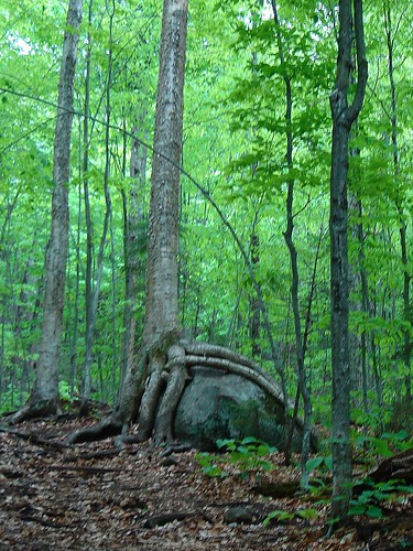
We stopped for a while to take pictures of the boulder hugging yellow birch. The self-guided tour booklet proposes that the boulder, covered in moss, lichen, and ferns provided conditions satisfactory enough for the yellow birch tree seed to sprout! It was gravity that pulled the roots down over the boulder, and it's predicted that the tree can survive another 300 years.
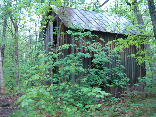
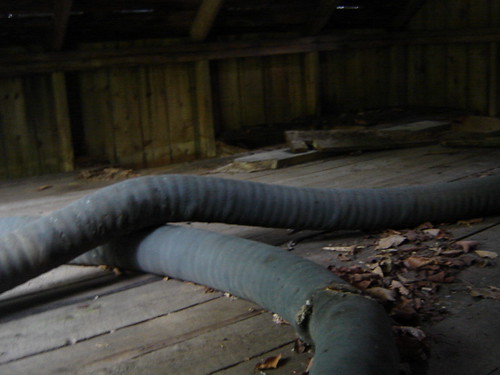
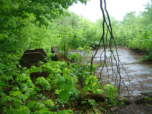
This is the old Huntington barn, which we used as shelter from the rain for a while. Up in the loft remains a fire hose, its opening peaking out the window of the loft. Several feet down the mountain appears to be the foundation and remains of Archer's cabin.
Just below the summit is a bedrock that we were able to catch some pictures through the breaking clouds from on the way back down. The bedrock, according to our booklet, is constantly changing, with minerals gradually be weathered from the edge. An earthquake centered at Goodnow Pond registered at 5.2 on the Richter Scale at 6:20 am on October 7, 1983.
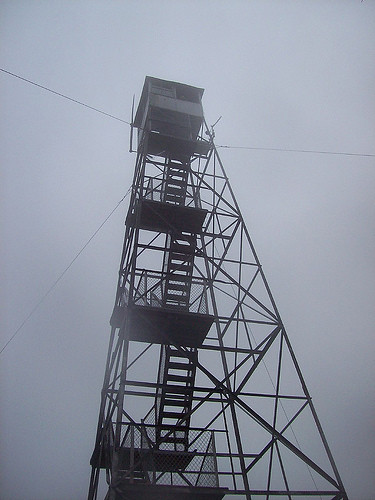
 Alas, the tower. Look closely up at the cab of the tower, that's me waving down to Sister. There is a 360o panoramic view from the top, but with the rain and clouds, we could not see it. I recommend checking out a 360o panoramic view provided by Carl E Heilman II. This was the first tower we were actually able to get up into the cab of, and only the 3rd tower we could climb all the way up. Inside the cab is a display with the job description of the observers, and a list of those who manned the tower from 1922-1979.
I have many, many more pictures available on my Flickr page that I recommend checking out. The photoset includes pictures and more detailed descriptions of our morning hike up Mt. Arab as well.
Mt. Goodnow is located in Newcomb, New York, and was named after Sylvester Goodnow who was the original owner of the mountain and had homesteaded the base of the mountain in the 1820s. The mountain was later purchased by Archer and Anna Huntington who out of love of the Adirondacks donated it to the College of Environmental Science and Forestry so that it could be preserved and maintained. The Huntingtons were a wealthy couple, Archer was a Spanish history scholar and his wife Anna was a sculptor. Some of her works can be seen in Brookgreen Gardens nears Myrtle Beach, SC. Below is a picture of one of Anna's sculptures taken by Sister on her vacation in Myrtle Beach.
"Diana of the Chase"
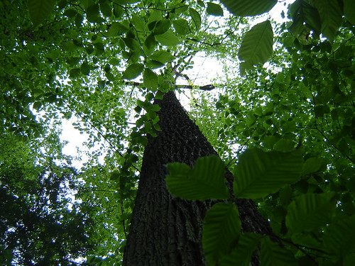
The College of Environmental Science and Forestry was kind enough to produce informational booklets about the mountain with a description of the history of the mountain and some stops along the way. The first station marked the tall sugar maples and white ash trees. It is suggested that a disturbance, such as wind, firewood gathering, or logging created a hole in the forest canopy allowing these trees to grow quickly, shading out the competitors. Perhaps the shade tolerant American beech trees will take their place some day. The trees towered above us, the actual tree tops out of sight due to the fog.
We stopped for a while to take pictures of the boulder hugging yellow birch. The self-guided tour booklet proposes that the boulder, covered in moss, lichen, and ferns provided conditions satisfactory enough for the yellow birch tree seed to sprout! It was gravity that pulled the roots down over the boulder, and it's predicted that the tree can survive another 300 years.
This is the old Huntington barn, which we used as shelter from the rain for a while. Up in the loft remains a fire hose, its opening peaking out the window of the loft. Several feet down the mountain appears to be the foundation and remains of Archer's cabin.
Just below the summit is a bedrock that we were able to catch some pictures through the breaking clouds from on the way back down. The bedrock, according to our booklet, is constantly changing, with minerals gradually be weathered from the edge. An earthquake centered at Goodnow Pond registered at 5.2 on the Richter Scale at 6:20 am on October 7, 1983.
 Alas, the tower. Look closely up at the cab of the tower, that's me waving down to Sister. There is a 360o panoramic view from the top, but with the rain and clouds, we could not see it. I recommend checking out a 360o panoramic view provided by Carl E Heilman II. This was the first tower we were actually able to get up into the cab of, and only the 3rd tower we could climb all the way up. Inside the cab is a display with the job description of the observers, and a list of those who manned the tower from 1922-1979.
Click on each picture for a zoom image
I have many, many more pictures available on my Flickr page that I recommend checking out. The photoset includes pictures and more detailed descriptions of our morning hike up Mt. Arab as well.
Information from:
The self-guided tour booklet provided by the College of Environmental Science and Forestry
and from the following websites:
http://en.wikipedia.org/wiki/Anna_Hyatt_Huntington
http://en.wikipedia.org/wiki/Archer_M._Huntington
http://www.nysfiretowers.com/Goodnow_Mountain.htm
http://en.wikipedia.org/wiki/Roosevelt-Marcy_Trail
http://www.naturepanoramas.com/41991521.html




1 comment:
Beautiful pictures! I love nature!
Post a Comment